

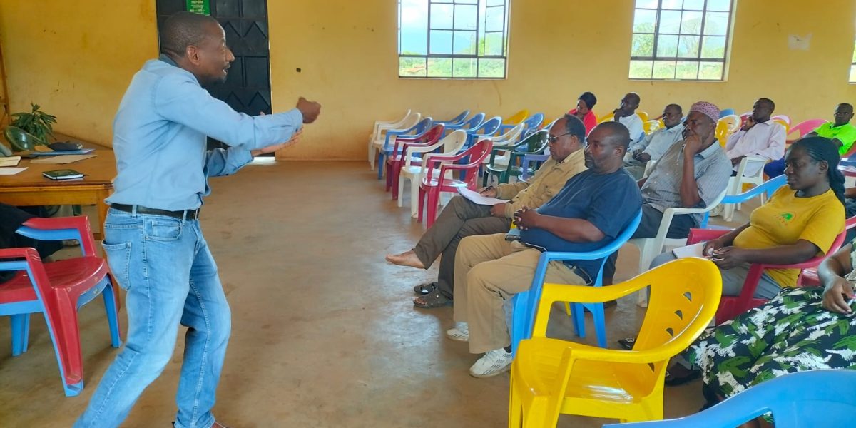
Taveta, Kenya — A newly released report from the Kanani Farmers Self-Help Group has laid bare the scale of the drainage crisis facing the Lower River Lumi, confirming what residents have long argued: that siltation, blocked channels, riparian encroachment and stalled institutional coordination — not lack of information — are what stand between Taveta and a functioning river system.
The report, compiled by the Lumi River Rehabilitation Secretariat following an August stakeholder forum, sets out the technical findings, the full list of institutions present, and a formal 12-point action plan with named responsible agencies, priority levels and timelines. The forum was partially supported by Taveta parliamentary aspirant Kamchuru Mnene, CEO of IRIS Executive Advisory Africa.
Who was in the room
The 25 August meeting at Sato Hall was not a purely community affair. Alongside farming communities and the Kanani Farmers Self-Help Group Executive Committee, it drew in county and national government representation: the Taveta Sub-County Administrator, the Sub-County Climate Change and Environment Officer, the Sub-County Agriculture Officer, the Sub-County Forest Officer, and a Kenya Forest Service officer. Also present were a representative of the Association of Kenyan Elders (TAKE), the Executive Director of COPDEC (the Citizen Network for Rural Development Kenya), and a representative of Serano Africa, which moderated the session.
That government presence matters: it means the officials with direct technical mandate over drainage, forestry, agriculture and environment in Taveta have already been briefed, in person, on the river’s condition — closing off any claim that county or national departments were unaware of the problem.
What the technical findings show
The report identifies five specific problem areas driving the crisis:
- Drainage infrastructure — siltation, debris accumulation and vegetation growth have reduced channel capacity across sections of the Lower Lumi, causing water stagnation and flooding of farmland.
- Riverbank management — recurring flood risk requires desilting, clearing of obstructions, rehabilitation of drainage structures and protection of erosion-prone banks.
- Encroachment — human activity and development close to the river and drainage corridors is obstructing natural water flow and heightening flood and degradation risk.
- Waste management — improper solid waste disposal is directly blocking drainage channels, a problem participants linked to weak community awareness and enforcement.
- Coordination — the report explicitly states that effective management “requires collaboration between national and county government departments, local administration, water and environmental agencies, community representatives, farmers, landowners and other relevant stakeholders” to avoid duplicated effort and ensure interventions actually hold.
The action plan, item by item
Unlike earlier discussions that stalled at the level of general concern, this report converts recommendations into a 12-item action plan with named responsible stakeholders, priority ratings and timelines:
- Technical assessment and mapping of drainage channels and critical river sections — County/National Government technical departments, High priority, Immediate
- Identification of blocked and heavily silted drainage sections — Technical teams and community representatives, High, Immediate
- Clearing debris and obstructions from priority channels — Authorities, community groups and partners, High, Short term
- Desilting of priority drainage channels — Technical agencies and partners, High, Short term
- Identification of areas vulnerable to erosion and flooding — Technical agencies and local stakeholders, High, Short term
- Protection and restoration of riparian areas — Environmental agencies, County Government, communities, Medium, Medium term
- Community sensitisation on waste disposal and drainage protection — County Government, environmental agencies, local administration, community leaders, Medium, Ongoing
- Discouraging encroachment and obstruction of drainage/riparian corridors — Relevant authorities and local administration, High, Ongoing
- Developing a routine drainage and river maintenance programme — Responsible authorities and community stakeholders, Medium, Medium term
- Mobilising resources for rehabilitation of critical infrastructure — County Government, national agencies, development partners, High, Medium/Long term
- Establishing a stakeholder monitoring and reporting mechanism — Lead coordinating institution and stakeholder representatives, Medium, Ongoing
- Convening a follow-up stakeholder meeting to review implementation — Lead institution and participating stakeholders, Medium, To be agreed
The plan’s structure is notable for what it does not leave vague: every item names who is accountable and on what timeline — the exact follow-through mechanism that residents and Kamchuru Mnene have publicly said was missing from the 2013 transboundary MoU and years of prior reports.
The community response team, in full
The meeting formally selected a team to lead immediate remedial work on the ecosystem: Mr Laurent Kipesha (Mata Zone, team leader), Mr Charles Wanyande (Mboghoni Zone), Mr Dominic Khamadi (Jipe Zone), Mr Fulgence Mangulute (Marodo Zone), Madam Petrina Disii (Mboghoni Zone), Mr Ambrose Hemed (farmers’ representative), and Mr Athman Kisakenyi (Buruma Zone).
The meeting closed at 1.30 p.m., with organisers thanking participants and stressing that continued collaboration — not another one-off meeting — is what will determine whether the plan is realised. The report was prepared by Angelo Mwamburi, Head of Secretariat, and confirmed by Ridhiwani Sadiki, Secretariat Coordinator, on 26 August 2026.
What it means for accountability
For Kamchuru Mnene, whose backing helped make the Sato Hall forum possible and who has framed the river’s decline as a case of “Stolen Waters” and institutional “Lazy Leadership,” the report gives her argument documentary weight. The presence of sub-county administrators, environment, agriculture and forestry officers at the meeting means responsibility for the twelve listed actions is no longer diffuse — it is attached to specific offices, with specific deadlines, on the public record.
The test now, as the region heads into a rainy season forecast to bring heavy — possibly El Niño-level — rainfall, is whether “Immediate” and “Short term” on this action plan mean what they say, or whether the Lower Lumi’s twelve-point plan joins the 2013 MoU on a shelf. A follow-up stakeholder meeting to review progress is expected, though the report notes its date is still “to be agreed.”